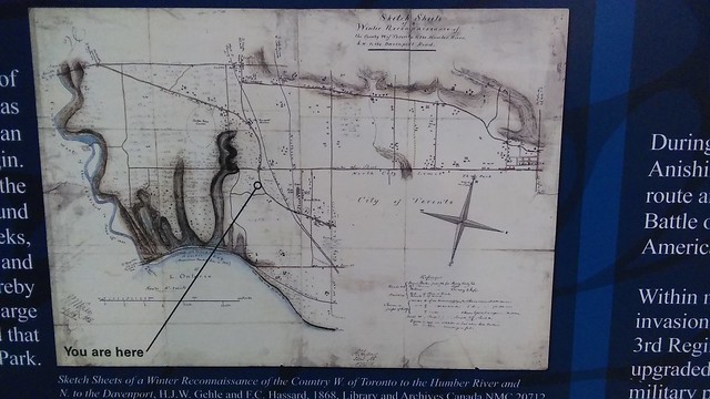
[PHOTO] Map of west Toronto, 1868
Nov. 12th, 2019 11:13 amThis map, displayed at the Dundas Roncesvalles Peace Garden parkette in the west-end neighbourhood of Roncesvalles, depicts territory that was--one year after the formation of Canada--still substantially rural. The map clearly shows the great arc of Dundas Street West as it curves north, avoiding what were then swamps and other lowlands and now substantially High Park, as well as the shallower curve of east-west artery Davenport Road to the northeast along the base of the escarpment marking the shoreline of the Ice Age's Glacial Lake Iroquois.
These territories have all been transformed radically, densely urbanized and booming. Even the Humber River that was once a boundary has become an internal waterway of the City of Toronto, Etobicoke on the western side being part of the legal city.
These territories have all been transformed radically, densely urbanized and booming. Even the Humber River that was once a boundary has become an internal waterway of the City of Toronto, Etobicoke on the western side being part of the legal city.